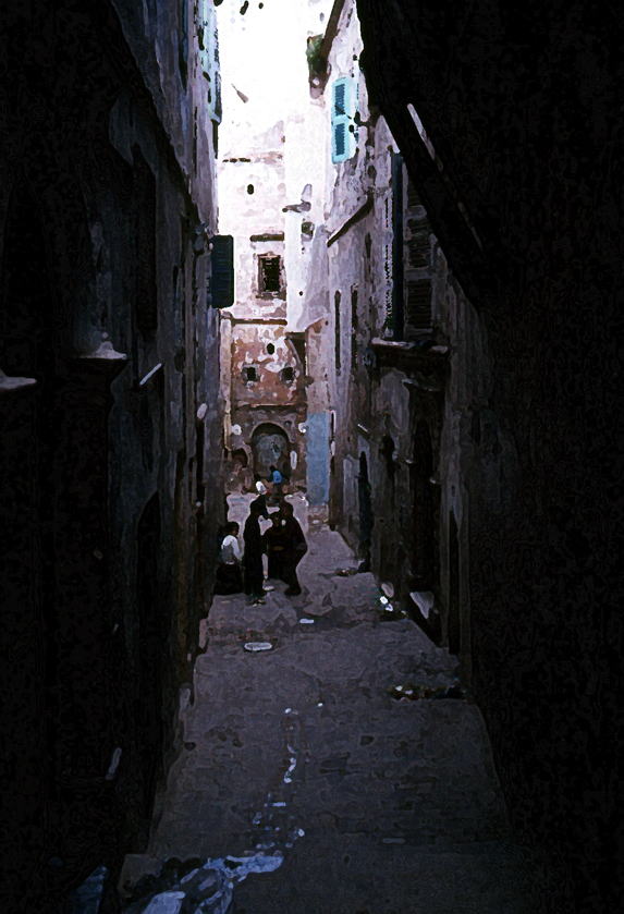
アルジェのふるさと・カスバの路地で遊ぶ子供 "La Kasbah(Casbah)", the oldest district of Algiers (世界遺産/World Heritage of UNESCO)
| From the Mediterranean Sea | to the Sahara desert area |
カスバの衛星写真と地図(Google)
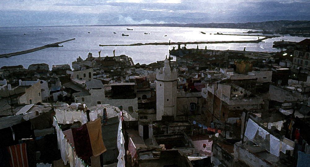
カスバ民家屋上から見たカスバとアルジェ港 この辺りのシーンは映画「ぺぺ・ルモコ」や「アルジェの闘い」にも登場した Alger port view from Casbah, Algiers(Alger)
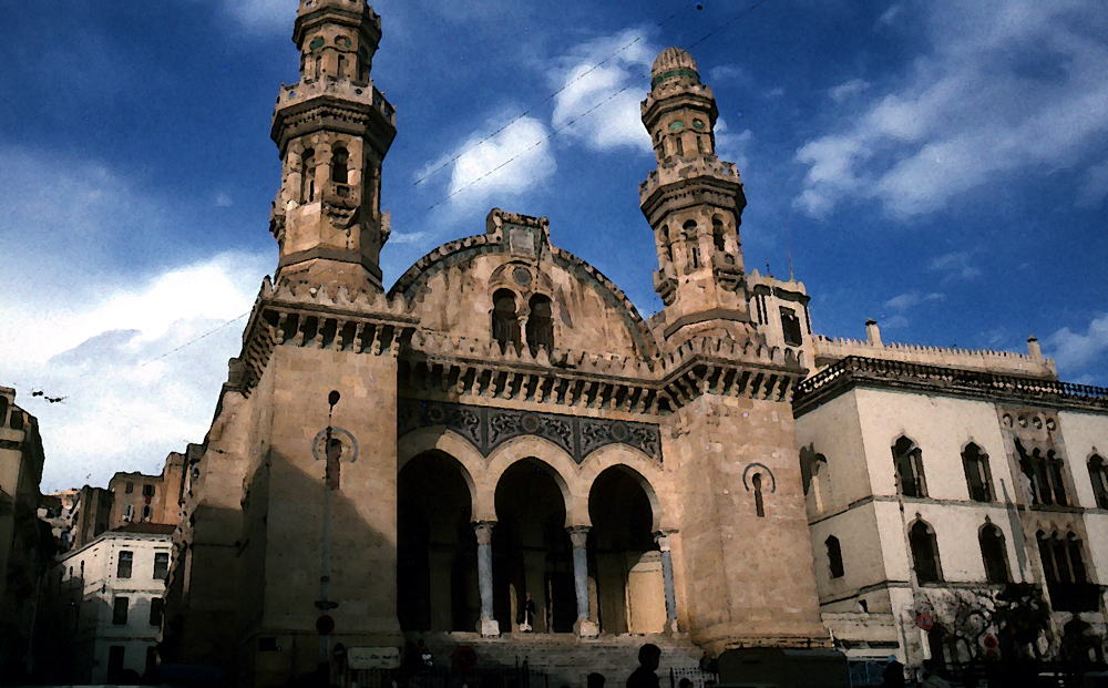
元カスバ地域にあるケチャウア・モスク 時代とともにキリスト教会やイスラム・モスクになった(マルティール広場) Kechaoua mosque at Place des Martyrs, ex.Kasbah, Algiers
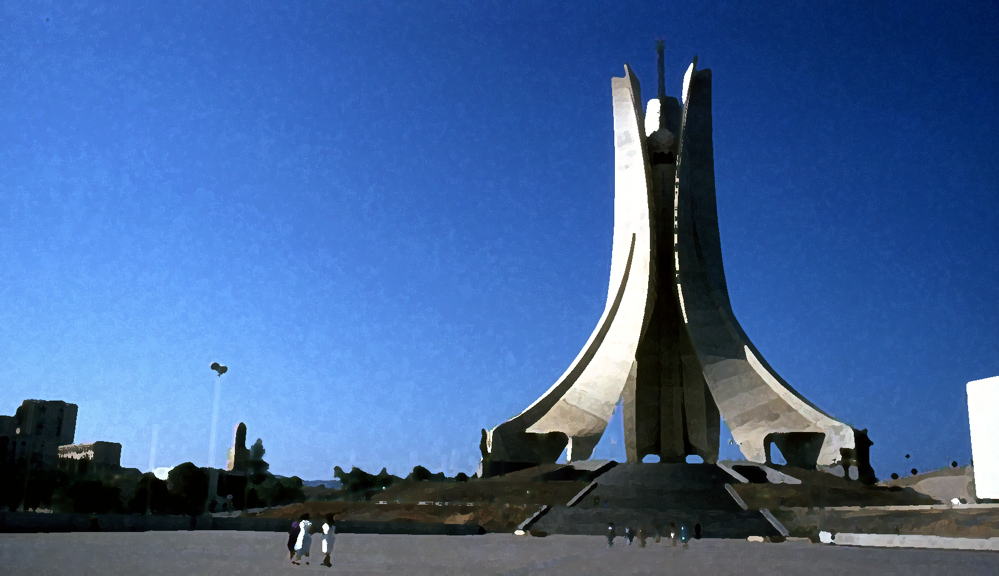
アルジェ市街を見下ろす丘上に作られた「独立記念塔」 フランスとの「独立戦争」の死者の英霊を祀る火が燃え続ける
"The Monument of Independence", Monumentdes Martyrs, Musee du Djihad, 衛星写真による塔と周辺(Google)
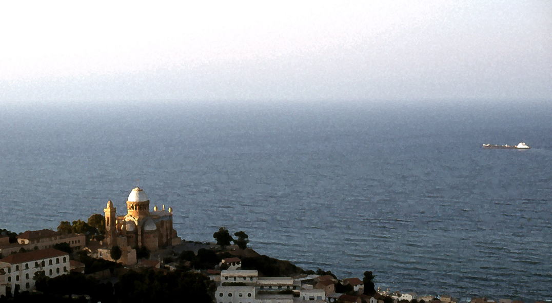
地中海を見下ろすノートルダム・ダフリーク(アフリカのノートルダム聖堂) フランス植民地時代に建造された Notre Dame d'Afrique and the Mediterranean Sea, outskirt of Algiers
衛星写真によるノートルダム・ダフリーク(Google)
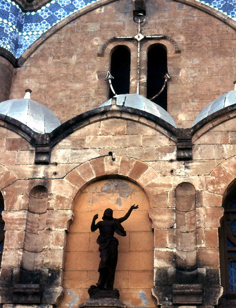
地中海の守護神・ノートルダム・ダフリークの「黒いマリア」と錨 So called "Maria la Noire" at Notre Dame d'Afrique
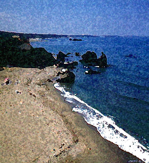
地中海の紺碧の空と海 Mediterranean seashore and sky in deep blue (near Ain Taya)
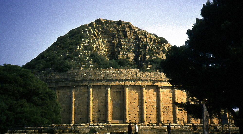
地中海を見下ろす丘上にあるモーリタニア王族の墳墓、通称「クレオパトラの娘の墓」(ティパサ郊外)
"Tombeau Royal Mauretanien,"so called "Le Tombeau de la Chretienne"or "Kbor er Roumia"(Arabic name) (Outskirt of Tipasa)
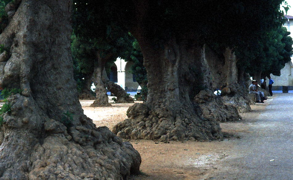
地中海岸シェルシェル(ローマ時代の首都カエサリア)のローマ広場にある根がコブだらけの「不条理の木」
Strange trees at Roma Square, Cherchell (ex.Mauritanian and later Roman capital "Caesarea" )
衛星写真によるシェルシェル(Google) アルジェリア史(Wikipedia)
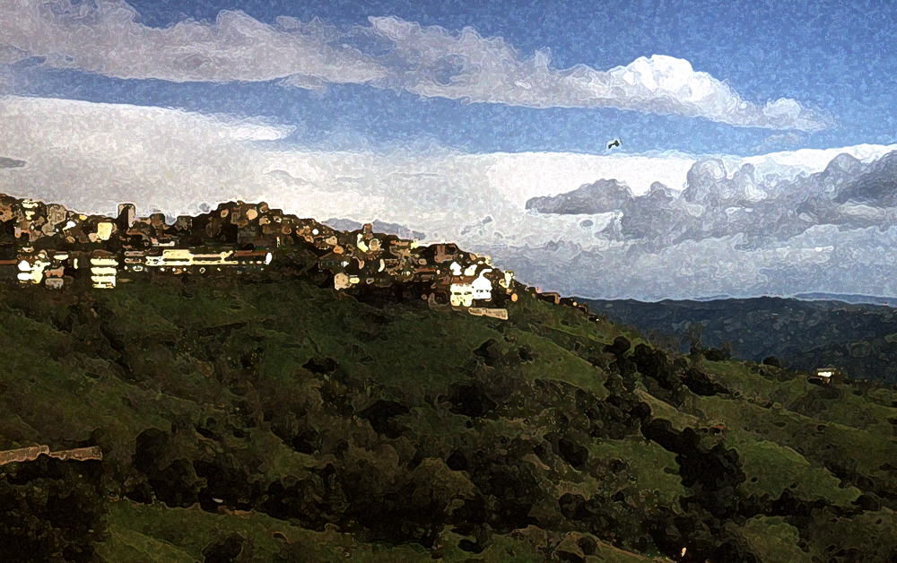
「ベルベル人」の故郷であるカビリー山地(グラン・カビリー) 長い歴史の結果ほとんどの集落は防御のために山頂や尾根にある
Most villages and towns are on the top or ridge of the mountain because of defence (Grande Kabylie, the East of Algiers)
「ベルベル人」?(Wikipedia)
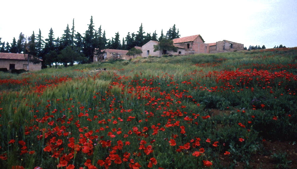
海岸アトラス山脈(テル・アトラス)の村の遅い春 芥子の赤色が印象的である Poppy in full bloom in late spring on the Atlas
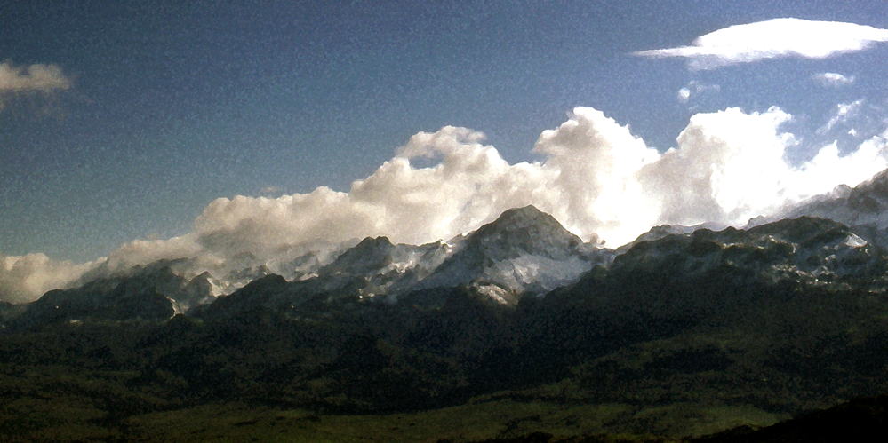
雪のアトラス山脈(テル・アトラス) 北アフリカでも小さいながらスキー場がある Snowy Atlas Mountains in winter They have some small ski-areas
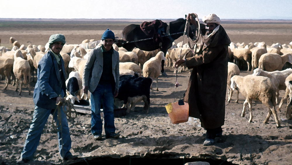
地下水脈フォガラにつながる井戸から家畜に水をやる遊牧民 Nomads at water hole along the water vein (the Steppe, Haut plateau next to the Sahara)
「フォガラ(カナート)」(Wikipedia)
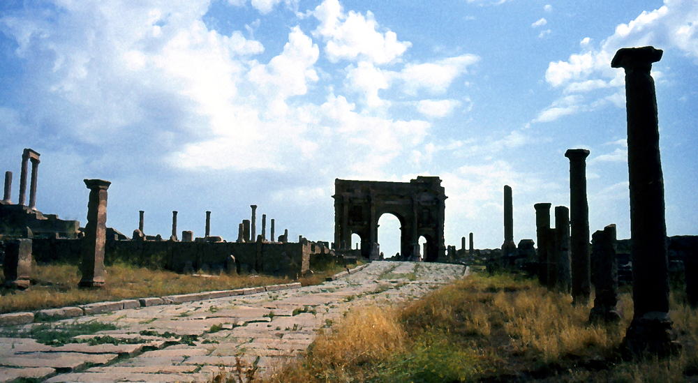
ティムガド遺跡の凱旋門とメインストリート(ローマ時代) ここはローマ絶頂期時代のトラヤヌス帝によって作られた
Timgad Roman ruins on the plateau (L'Aures) 衛星から見た遺跡(Google) ティムガド遺跡(wikipedia)
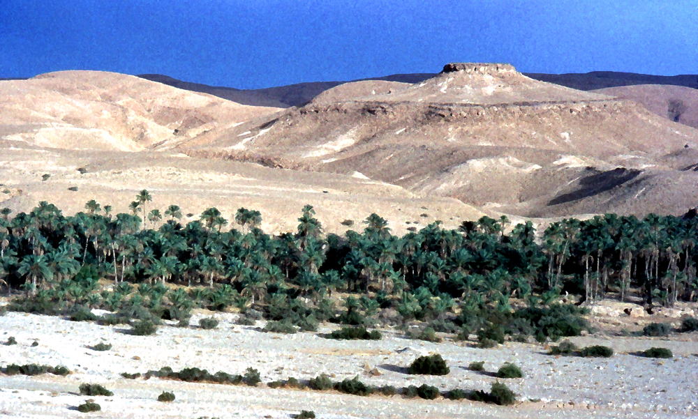
沙漠のナツメヤシ園 ナツメヤシの実ダッツは栄養価の高い大切な食料 (ビスクラ付近) Palmetto in some oasis (Biskra, northern part of the SAHARA)
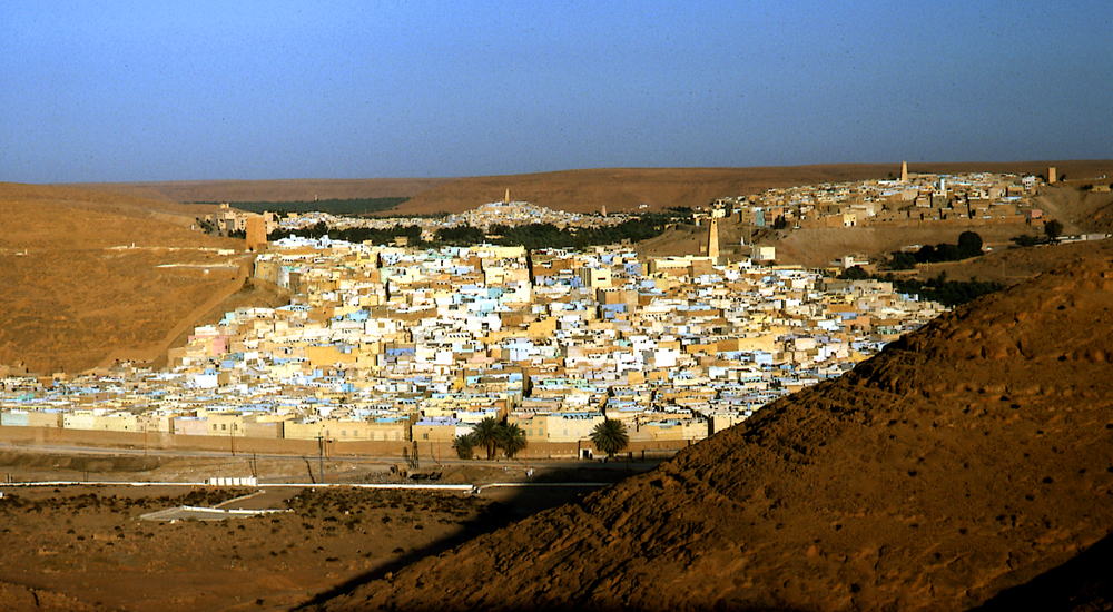
サハラ西沙漠最大のオアシス・ガルダイア 巨大な窪地の底にあるムザブ地方の中心(世界遺産/World Heritage of UNESCO) Oasis Ghardaia, M'zab
衛星から見たガルダイア(Google) Ghardaia oasis(Wikipedia)
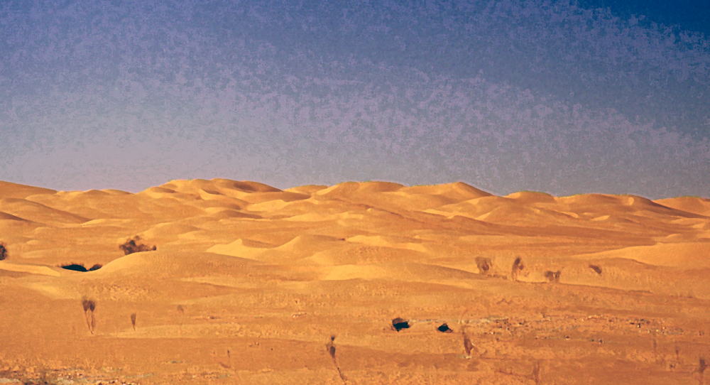
サハラ西沙漠の砂丘群(ガルダイア-エルゴレア) Dunes in the Sahara occidental between Ghardaia and El Gorea Dunes move more than 10〜20km by strong wind in a year
衛星写真によるサハラ砂丘群(Google)
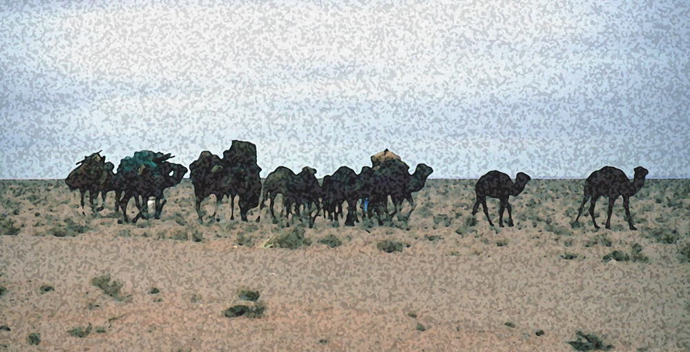
テントを含む全財産をラクダに載せて移動する遊牧民 女たちは徒歩で、家長は馬に乗り、赤子はラクダの背中に括り付けられていた (サハラ東沙漠)
Nomads moving elsewhere with all their household goods including tents (The Sahara Oriental)
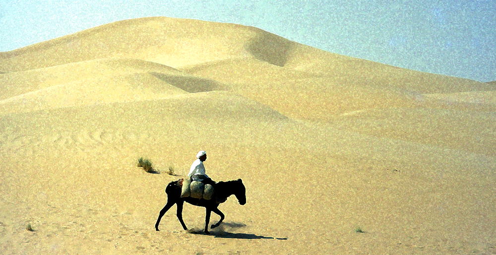
ロバはもっとも重要な交通手段である (サハラ東沙漠・エルウェッド郊外) サハラも東西で砂色が大きく異なる Man on a donkey (El Oued, le Sahara Oriental)
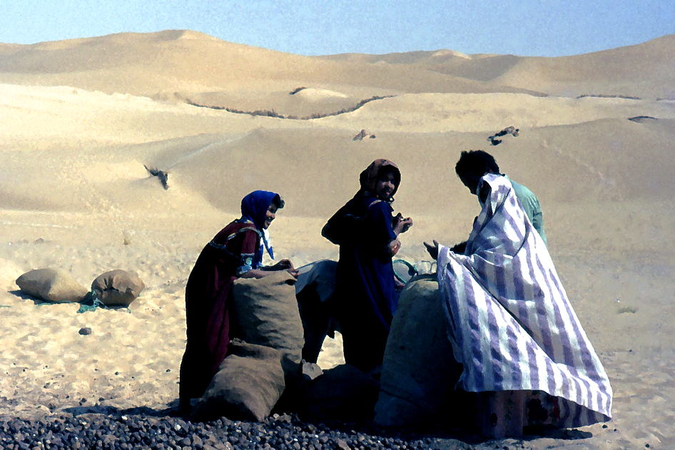
沙漠の民の燃料「らくだの糞」集め(エル・ウェッド) Nomads gathering camel dung as their household fuel (El Oued)
内部リンク:「フツーの日本人があまり知らないアルジェリア」(Unknown Algeria to the Japanese people)
このページの写真は1983-1986に撮影したフィルム写真ネガをスキャナーで読み込んだ物です
(C)1983-1986 All Rights Reserved by Kenji Kakehi All the photos are modified by "Photoshop"
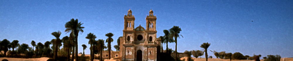
サハラ中央部のオアシス・エルゴレア郊外にある仏植民地時代の名残・元キリスト教会 フランス人宣教師・フーコー(Charles de Foucauld)もここに眠る (L'eglise, Oasis El Gorea)